Spatial management is a type of fisheries management that places different levels of restrictions on fishing in a specific area. Spatial management areas also have a time component– they can be temporary, long-term, or permanent.
The Spatial Management Guidance was developed to provide simple and accessible guidance on how to design spatial management areas to help rebuild fish populations.
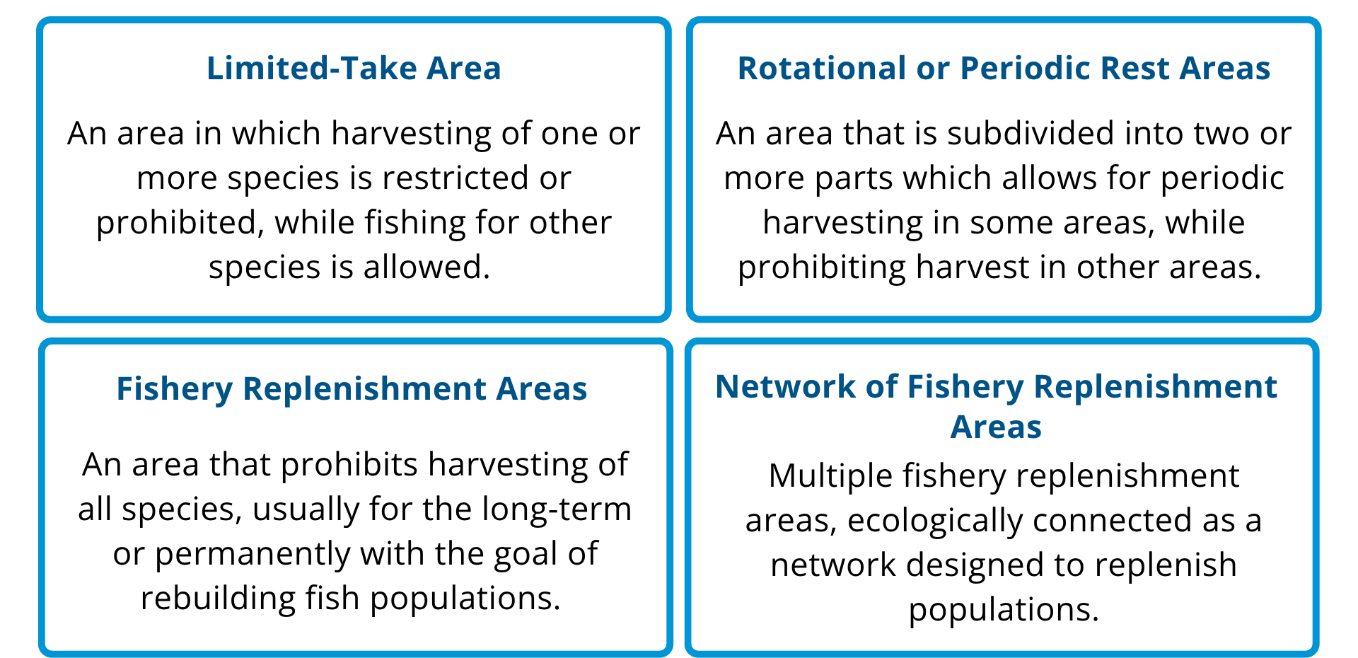
There are different types of spatial management areas.
The Spatial Management Guidancesupports users in thinking through the most important characteristics of designing a spatial management area. It includes: printable guidance and activities, presentation materials, and a table of ecological information for key fish species.
What does the spatial guidance do?
Spatial Management Guidance
FishKit Coastal Fisheries Science and Management Handbook
Developed by The Nature Conservancy’s FishKit team, this handbook is a practical guide for coastal communities and practitioners working to sustain small-scale fisheries. It introduces key concepts in fisheries science and management, blending traditional knowledge with modern tools to support data-driven, community-led decision-making. With accessible modules, visual aids, and interactive tools like the FishKit platform, the handbook empowers users to assess fishery health, design effective management strategies, and ensure long-term sustainability of marine resources. Information relevant to spatial management can be found throughout, with specific sections on spatial management and Fishery Replenishment Areas (FRAs) found in module 17 and 18.
Ecological Information Table for Coastal Species in the Pacific
This expert curated table summarizes important ecological information such as habitat requirements, movements and recovery rates for focal coastal fisheries species cross Hawai’i, Micronesia, Polynesia and Mexico. This information is designed to be a resource to facilitators and community groups looking to better understand the ecology of their fisheries species.
Facilitator's Guide to Designing Fishery Replenishment Areas
This facilitator’s guide supports a group training activity to design one or more Fishery Replenishment Areas (FRAs) to meet objectives focused on rebuilding populations of priority fishery species. It provides a five -step process with key messages and guidance on using bio-physical design guidelines, species-specific ecological information, socio-economic and cultural considerations, and local knowledge to develop management recommendations on the design of FRA(s) with a focus on priority fishery species.
Spatial Management for the Pacific Introductory Slides
These are resources designed to provide general guidance on implementing spatial management for fisheries in the Pacific. The four slide decks summarize best practices and design principles to aid communities as they design spatial management strategies to enhance and maintain coral reef fisheries.